troutdude
Moderator
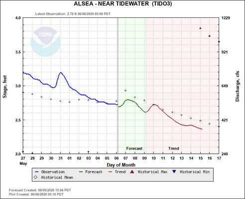
Here is a graph showing the flood stage, and predictions, for the Alsea River @ Tidewater.
It's worthy to note, that this happened in JUST ONE DAY!!! :shock: :shock:
The snow melt on Alsea Mountain, and Mary's Peak, and goes down the creeks and right into the river proper. It'll be a while before it's either safe or fishable.
http://www.nwrfc.noaa.gov/river/station/flowplot/flowplot.cgi?lid=TIDO3
Last edited:
